Strategically Located Land Index Tool for Agriculture and Human Settlements

A multi-criteria approach was undertaken with regards to this project. The project brief required that a Spatial Index be created so as to identify strategically located land for human settlements and specific agricultural commodities in South Africa. The Strategically Located Land Index (SLLI) was also required to be deployed through an online web viewer/portal that allowed for land to be identified and reports to be drawn up.
The development of the SLLI Tool provided a standardized framework which assists the decision-making process in identifying land which is highly suitable for agriculture as well as human settlements.
South Africa’s unique landscape required that the SLLI index assess land suitability, while considering that each portion of land experiences a different set of features that make it more or less suitable for certain agricultural practices. As such identifying suitable land proved to be a very complex process, the approach used to develop the SLLI tool involved a GIS centered multiple-criteria decision analysis process. Stakeholder consultation & participation was required to inform the entire GIS process. The process involved criteria identification, statistical weighting of criteria, spatial analysis of criteria, assigning of rule sets and finally the generation of multiple Strategically Located Land Indexes; for the top 10 agricultural commodities and for human settlements.
A 50m resolution was achieved for each SLLI and as such allows for suitability differences to be seen on individual land plots throughout the entire country.
Climate Analysis for Crop Cultivation Suitability Periods

We were able to help the client by spatially applying an algorithm to climate data that was based on a number of temperature prerequisites. Raw climate raster data was processed month by month to identify the lowest recorded temperature for a specific pixel, these pixels were then mosaiced into a new raster layer recording the absolute lowest temperature and month recorded. This output was then run through several raster math processes, as specified by the client’s algorithm. The final output was reclassified to identify the calendar weeks that met the required climatic ranges from germination to harvest.
Line of Sight Analysis for potential Wind Farm locations

Line of sight analysis was conducted for the identification and establishment of potential wind farm sites that fall within a 50km radius of the radar stations at Cape Town International Airport. Areas identified included large depressions or areas located behind hills that could accommodate the full length of a turbine, including blade span of 150m+, thus mitigating the risk of interfering with radar operations.
Church Location and Needs Analysis
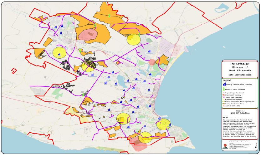
This project required the identification of sites for the potential establishment of new Church sites within the Diocese, informed by planned and approved urban expansion nodes and transportation plans as outlined in the Spatial Development Framework for the Metro.
Land Parcel Classification

Land Parcels were classified using satellite imagery in Priority wards for the potential construction of:
♦ Standalone dwellings on the remainder of an ERF
♦ Floating units (housing built on stilts above existing houses) where roof pitch allows
♦ Vacant erven for potential development of new housing
♦ Public Open Spaces for community centered agricultural projects
NGO Aftercare School locations

A spatial representation was created showing School aftercare locations in order to identify them on a map of South Africa. This helped to identify spatial relationships between Schools and various other important assets in their ward.
Building Footprints
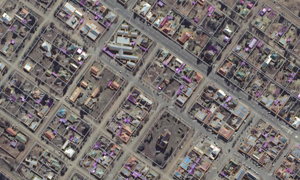
Building footprints were captured using satellite imagery. A Building footprint is the area of a building measured from the outer surface of the exterior of the building.
Event Route Mapping and profile

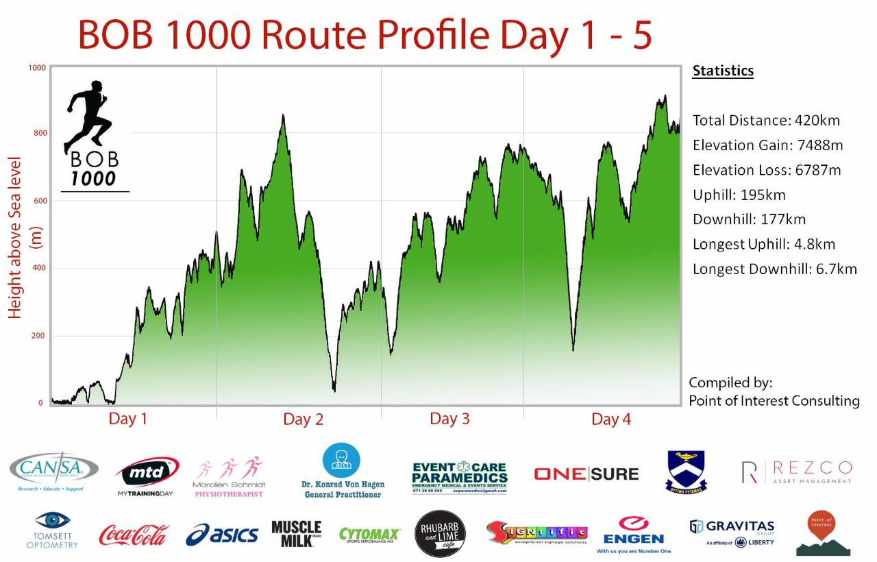
In 2017, BOB 1000, a charity event, covered 1000 km from Port Elizabeth to Durban, over 10 days, culminating with the Comrades Marathon. The event route was planned along with route profiles indicating the elevation gains/losses. Road networks were analyzed to identify daily routes and overlaying these onto A DEM so as to obtain route profiles.
Legal Advise

Conduct analysis, findings reports and provide recommendations regarding a property boundary dispute between neighbours.
Festival Mapping
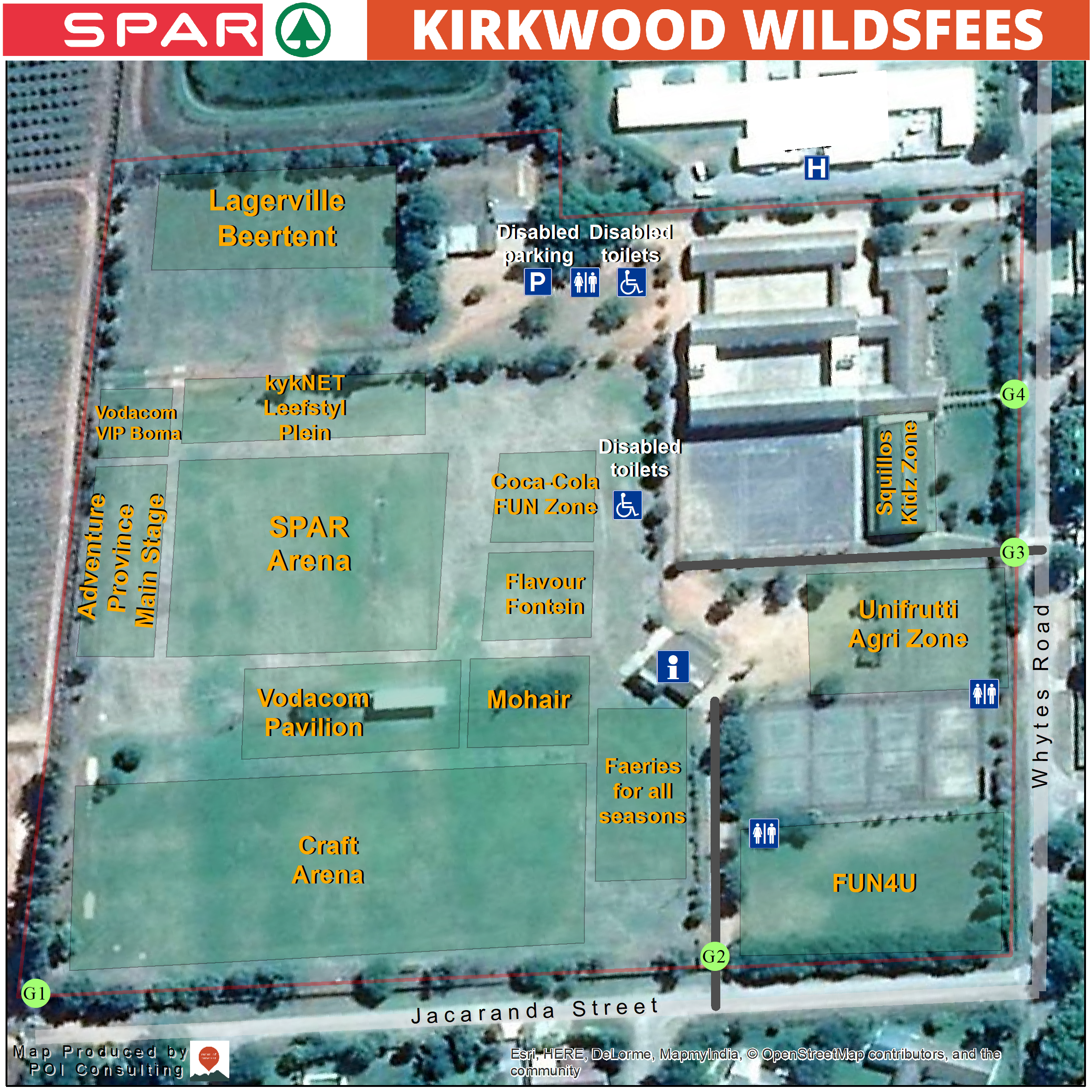

The client needed assistance in updating and making their festival map more user-friendly as festival-goers had found it difficult to navigate around the festival grounds in previous years. As a solution, a high-resolution aerial image of the festival grounds was used as a base map onto which the festival layout was overlayed. A map highlighting the main routes to and from the Kirkwood Wildsfees was also created based on analysis of road network.
